Bullaburra to Linden Floodplain Risk Management Committee
Share Bullaburra to Linden Floodplain Risk Management Committee on FacebookShare Bullaburra to Linden Floodplain Risk Management Committee on TwitterShare Bullaburra to Linden Floodplain Risk Management Committee on LinkedinEmail Bullaburra to Linden Floodplain Risk Management Committee link
Consultation has concluded
What is the study about?
Residents of south Bullaburra, south Lawson, south Hazelbrook or south Woodford of the Great Western Highway are encouraged to apply to be part of the Floodplain Risk Management (FRM) Committee.
There are two vacant positions on the FRM Committee for local residents. For those who are interested in being a part of the FRM Committee can make a submission using the online form below.
Submissions should include full contact details and a short statement about why you would like to be on the committee. Submissions are due by 31 August 2018.
There will be up to 4 meetings per year which will be scheduled on weekday evenings.
It is important that people who live in the study area are represented on this committee because they have a lived experience of how local floodwaters behave in the landscape.
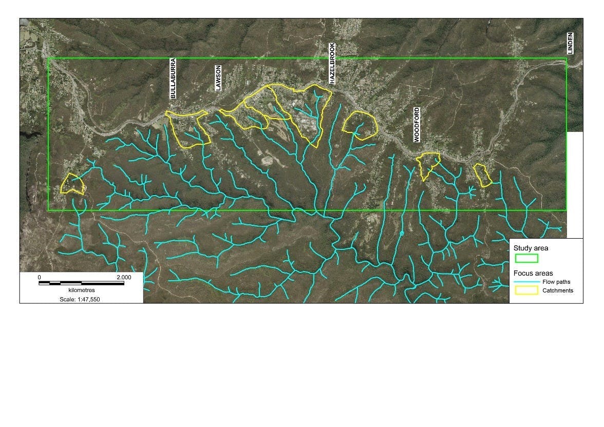
The purpose of the study is to model extreme weather events and identify the risk to people's safety and damage to property from flood waters. The study areas are located south of the Great Western Highway and are shown in the map.
What is the study about?
Residents of south Bullaburra, south Lawson, south Hazelbrook or south Woodford of the Great Western Highway are encouraged to apply to be part of the Floodplain Risk Management (FRM) Committee.
There are two vacant positions on the FRM Committee for local residents. For those who are interested in being a part of the FRM Committee can make a submission using the online form below.
Submissions should include full contact details and a short statement about why you would like to be on the committee. Submissions are due by 31 August 2018.
There will be up to 4 meetings per year which will be scheduled on weekday evenings.
It is important that people who live in the study area are represented on this committee because they have a lived experience of how local floodwaters behave in the landscape.
The purpose of the study is to model extreme weather events and identify the risk to people's safety and damage to property from flood waters. The study areas are located south of the Great Western Highway and are shown in the map.
Share Submission for FRM Committee on FacebookShare Submission for FRM Committee on TwitterShare Submission for FRM Committee on LinkedinEmail Submission for FRM Committee link